Difference between revisions of "Sinus Medii"
(Skyhook) |
(Surveyor) |
||
| (4 intermediate revisions by one other user not shown) | |||
| Line 1: | Line 1: | ||
{{stub}} | {{stub}} | ||
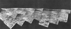
[[Image:Sinus Medii Surveyor VI p74a.jpg|thumb|300px|right|Sinus Medii - NASA - Surveyor VI - 1967]] | [[Image:Sinus Medii Surveyor VI p74a.jpg|thumb|300px|right|Sinus Medii - NASA - Surveyor VI - 1967]] | ||
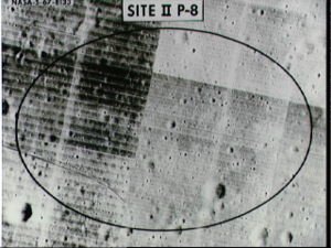
| + | [[Image:10074655.jpg|thumb|300px|right|Sinus Medii - NASA S67-08133 - Lunar Orbiter II - 1966]] | ||
Translation of Name into English: Bay of the center | Translation of Name into English: Bay of the center | ||
| Line 10: | Line 11: | ||
It is where the center of the official IAU lunar coordinates system is located, i.e. Longitude-0 on the lunar Equator. | It is where the center of the official IAU lunar coordinates system is located, i.e. Longitude-0 on the lunar Equator. | ||
| − | Surveyor VI landed on the flat surface of Sinus Medii, at 1.40° W, 0.49° N, on November 10, 1967, at 01:01:05 GMT. It came to rest near a mare ridge, visible in the lunar vista above (top right). | + | [[Surveyor]] VI landed on the flat surface of Sinus Medii, at 1.40° W, 0.49° N, on November 10, 1967, at 01:01:05 GMT. It came to rest near a mare ridge, visible in the lunar vista above (top right). |
It would be the ideal site to place a rectenna (receiving antenna) to receive microwave energy beamed down from [[Solar Power Satellites]] located at the Lunar L-1 Lagrange libration location between the Earth and the Moon. | It would be the ideal site to place a rectenna (receiving antenna) to receive microwave energy beamed down from [[Solar Power Satellites]] located at the Lunar L-1 Lagrange libration location between the Earth and the Moon. | ||
It would also be the best site for an anchor point to attach a [[tether]] for a [[Skyhook]] extending up to the Langrange L-1 libration location between the Earth and the Moon. | It would also be the best site for an anchor point to attach a [[tether]] for a [[Skyhook]] extending up to the Langrange L-1 libration location between the Earth and the Moon. | ||
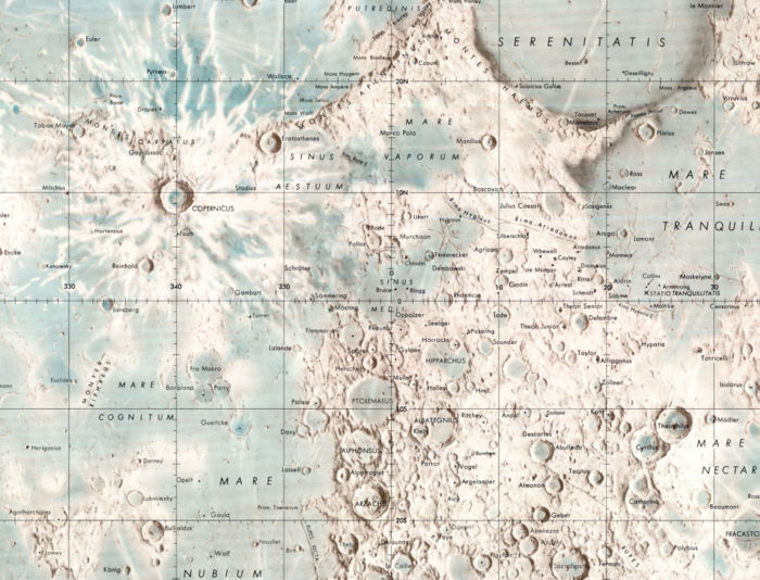
| + | [[Image:Sinus Medii 150dpi.jpg|thumb|700px|left|Sinus Medii - NASA - LMP-1 Lunar Earthside Chart - 1976]] | ||
[[Category:Locations]] | [[Category:Locations]] | ||
Latest revision as of 10:21, 28 April 2007
| This article is a stub. You can help Lunarpedia by expanding it or sorting it into the correct stub subcategory. |
Translation of Name into English: Bay of the center
Center: 2.4° N 1.7° E
Diameter:335 km
This is the region at the center of the side of the Moon which faces the Earth. It is where the center of the official IAU lunar coordinates system is located, i.e. Longitude-0 on the lunar Equator.
Surveyor VI landed on the flat surface of Sinus Medii, at 1.40° W, 0.49° N, on November 10, 1967, at 01:01:05 GMT. It came to rest near a mare ridge, visible in the lunar vista above (top right).
It would be the ideal site to place a rectenna (receiving antenna) to receive microwave energy beamed down from Solar Power Satellites located at the Lunar L-1 Lagrange libration location between the Earth and the Moon.
It would also be the best site for an anchor point to attach a tether for a Skyhook extending up to the Langrange L-1 libration location between the Earth and the Moon.


