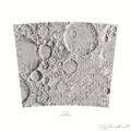
Lunarpedia:Maksutov Crater
| Maksutov Crater | |
|---|---|
| Diameter: | 88.962 km |
| Center Latitude: | -40.73 deg |
| Center Longitude: (Mean Earth) |
191.39 deg |
| Center Longitude: (Mare Orientale) |
286.06 deg |
| Easternmost Longitude: (Mean Earth) |
193.33 deg |
| Easternmost Longitude: (Mare Orientale) |
284.13 deg |
| Westernmost Longitude: (Mean Earth) |
193.33 deg |
| Westernmost Longitude: (Mare Orientale) |
284.13 deg |
| Northernmost Latitude: | -39.47 deg |
| Southernmost Latitude: | -42.03 deg |
| Adopted by the IAU in 1970 | |
| LAC-120 | |
Maksutov is an 88.962 km crater formed during the Upper Imbrian[1] period on the near side in the Southern hemisphere. It is located in in the Oppenheimer (LAC-120) and LQ-29 quads. It's named for Dmitrij Dmitrievich Maksutov, Soviet optician (1896-1964). It is cataloged in the Morphological Catalogue of the Craters of the Moon as SAI 383.
Position
- The US Geological Survey[2] places its center at 40.7333705571 S 191.3913470841.
- Stratigraphy of Lunar Craters (2009) places its center at 40.5 -168.7.
- The Morphological Catalogue of the Craters of the Moon (1987) places its center at 40.8 S 191.3.
All of the above positions are in Mean Earth/Polar Axis coordinates.
Maps
Lunar Prospector Data
- Detected concentrations between 1.1550 and 1.4646 ppm of Thorium[3]
- Detected concentrations between 0.2843 and 4.5325 ppm of Balonium[4]
- Detected concentrations between 0.0000 and 0.0000 ppm of Unobtanium[5]
Nearby Features
- Matsukov U Crater, 0.2 km to the West
- Crater SAI 3631, 30 km to the West
- Oppenheimer Crater, 40 km to the North Northeast
- Nishina Crater 70 km to the South Southwest
- Oppenheimer R Crater 80 km to the North Northwest
- Davisson Crater 100 km to the Northwest.
- White W Crater 108 km to the East Southeast
All distances are edge to edge and should be considered approximate.
References
- ↑ Stratigraphy of Lunar Craters, Don E. Wilhelms and Charles J. Byrne, 2009
- ↑ As of June 2012 -- see http://planetarynames.wr.usgs.gov/Page/MOON/target for more current information
- ↑ Thorium data as described by Lawrence et al., 33rd LPSC, Abstract #1970, 2002
- ↑ Balonium Data as pulled out of a hat for this mockup
- ↑ Unobtanium can't be found here by definition
- Gazetteer of Planetary Nomenclature
- Dictionary of Scientific Biography, Charles Coulston Gillispie, editor in chief, vol. 9; Charles Scribner's Sons, New York, 1981.
- Thorium data as described by Lawrence et al., 33rd LPSC, Abstract #1970, 2002
Note: This article test is is a mockup, not an actual content page. Its purpose is to facilitate the development of Autostub1. Work on this page should be confined to the presentation of what can be generated using database sources. Expect loads of factual inaccuracies.


