File:Alliance-map 2009-04-02.png

Size of this preview: 591 × 600 pixels. Other resolutions: 236 × 240 pixels | 800 × 812 pixels.
Original file (800 × 812 pixels, file size: 9 KB, MIME type: image/png)
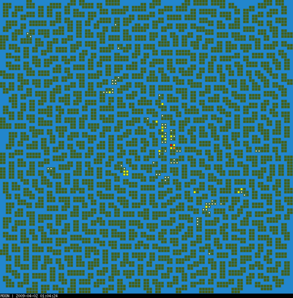
118 towns extracted from the Embassy list.
Tiny white dots: islands with 1 alliance town.
Yellow dots: islands with 2-3 alliance towns.
Orange dots: islands with 4-5 alliance towns.
Red dots: islands with 6+ alliance towns.
Generated by Ikariam AutoMap Utility v0.8.2
File history
Click on a date/time to view the file as it appeared at that time.
| Date/Time | Thumbnail | Dimensions | User | Comment | |
|---|---|---|---|---|---|
| current | 21:09, 1 April 2009 |  | 800 × 812 (9 KB) | Mdelaney (talk | contribs) | Ikariam AutoMap Utility - Result page. 118 towns extracted from the Embassy list. Tiny white dots: islands with 1 alliance town. Yellow dots: islands with 2-3 alliance towns. Orange dots: islands with 4-5 alliance towns. Red dots: islands with 6+ alliance |
You cannot overwrite this file.
File usage
There are no pages that use this file.


